 Lebensraumvernetzung Geodata
DI Florian Danzinger
Type of resources
Topics
Keywords
Contact for the resource
Provided by
Representation types
Update frequencies
status
Scale
-
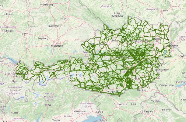
Austrian Ecological Corridors - final version. Valued by the experts of the federal provinces. Prepared in the framework of the LE project "Habitat connectivity to safeguard biodiversity in Austria".
-
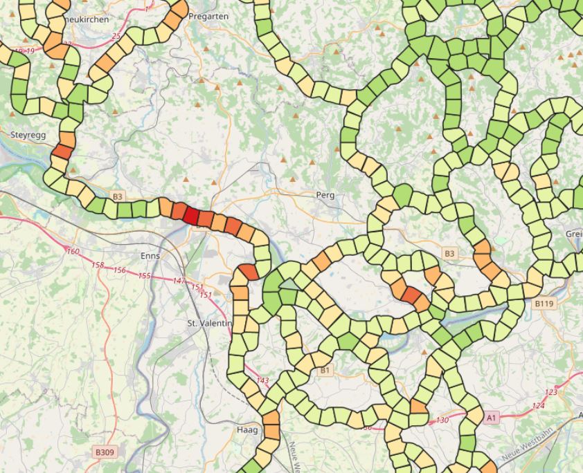
LRVA-2022: Evaluation of ecological corridor axes with regard to the permeability of sections of the ecological corridor. On the one hand, the landscape structure is assessed with regard to its permeability (LC structure index) and on the other hand, the landscape elements equipment of the ecological corridor segment (LE equipment index) is considered. The combination of these two indicators results in the combined ecological corridore index, which gives a good overview of ecological corridor areas with low permeability.
-
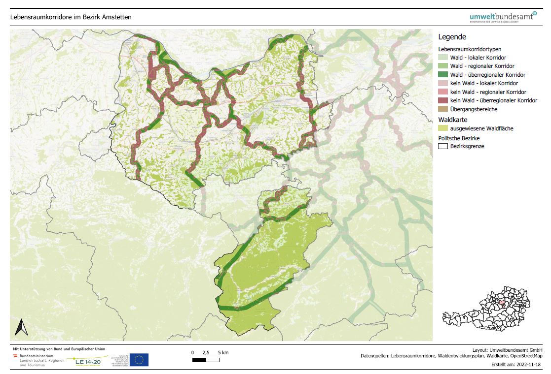
LRVA-2022: Generated standard map representation of the special topic maps for ecological corridors in Austria for the forest development plan. The maps are automatically updated as soon as the data basis (=modification of ecological corridors or modification forest mask from the Federal Forest Research Centre /BFW) changes.
-
LRVA-2022: Current version of the integral dataset on habitat connectivity in Austria. This dataset takes into account all datasets and designations of habitat corridors from scientific projects and public sector projects (federal provinces). The dataset has been evaluated by the experts of the Cooridnation Platform "Habitat Connectivity Austria" and is updated as soon as new information and designations from projects are available. For further details: https://geonode.lebensraumvernetzung.at/documents/107/download